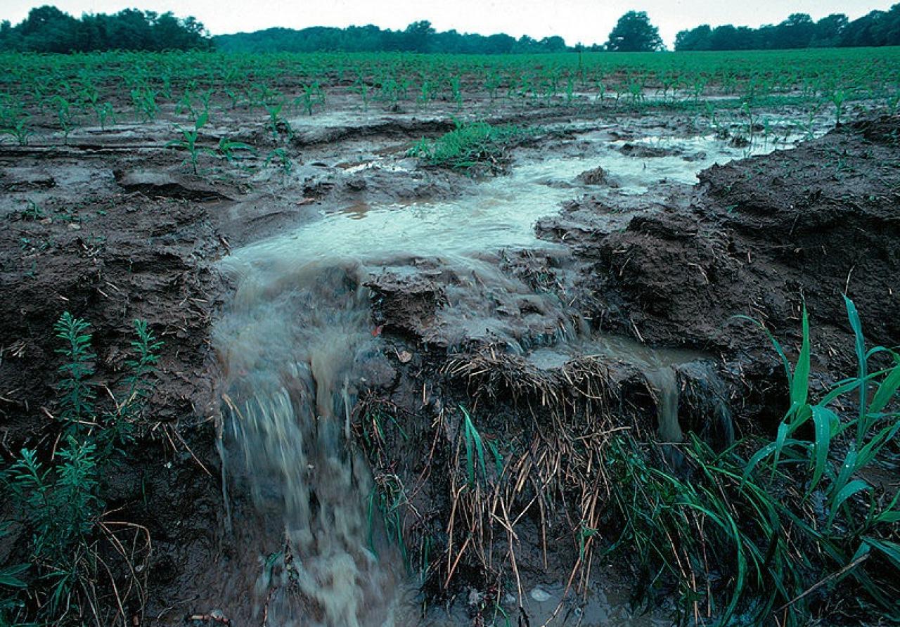
Without a buffer strip of grass or other perennial vegetation, water runs straight off a farm field, carrying phosphorus, nitrogen and sediment into nearby streams, lakes and rivers.
Originally published by Friends of The Mississippi River
Bowing to pressure from agribusiness groups and Republican lawmakers, Gov. Mark Dayton made statewide news with a surprise announcement in late-January: a major portion of the 2015 buffer bill is being rolled back. As a result, hundreds of miles of private ditches will be exempt from buffer requirements and will continue to carry polluted farm runoff into Minnesota’s waters.
Buffer law a bright spot of 2015
The passage of Gov. Mark Dayton’s much-discussed buffer initiative was one of the few bright spots in an otherwise troublesome 2015 legislative session. The law established new perennial vegetation plantings or buffer strips along rivers, streams and ditches to help filter out phosphorus, nitrogen and sediment.
The landmark initiative required two types of buffers:
• Public waters buffers: A 50-foot average buffer (with a minimum width of 30 feet) of continuous perennial vegetation along all “public waters” by November 1, 2017.
• Ditch buffers: A 16.5-foot minimum buffer of continuous perennial vegetation along ditches within the “benefited area” of public drainage systems by November 1, 2018.
The law directed the Minnesota Department of Natural Resources (DNR) to develop maps identifying which streams and ditches fall into the above categories, and share those maps with landowners and local governments to assist in implementation.
Suddenly off the map in 2016: Private ditches
One key to the initiative’s potential success was its application to both private and public ditches. Since private ditches often discharge polluted runoff to public ditch systems that local landowners help pay to maintain*, it seemed only fair that private ditch owners install buffer protections as well. However, since the governor’s recent announcement, we now know the exact number of private ditches protected by the buffer bill: zero.
According to Gov. Mark Dayton’s statement, he instructed the DNR to stop mapping private ditches after House Republicans threatened to kill pressing public works water-quality projects: “Threats have been reported to me that DNR and [Minnesota Board of Water and Soil Resources] bonding requests — which are urgently needed to address the state’s serious water quality and infrastructure challenges — would not be considered by House leadership if private ditches were not retroactively exempted from the new buffer requirement.”
As Dayton expressed his reluctance to order this action, the Minnesota Farmers Union, Minnesota Farm Bureau, Minnesota Corn Growers Association and the Minnesota Soybean Growers Association were all quick to publicly thank him for allowing their members to farm right up to the water line. In a recent Pioneer Press article on the governor’s announcement,FMR Executive Director Whitney Clark asked who really insists on farming up to the water’s edge: “The first thing I thought [after the announcement] was who are all these people who want to farm right up to the edge of their ditch? Who are all the people who are asking for that, and is that in the public interest? … It’s stunning that that’s the position that opponents of buffers are taking.”
Also off the map? Many streams and wetlands
Beyond the exemption for private ditches, the DNR’s maps could result in far fewer public waters protected by buffers. The maps currently being developed by the DNR fail to include and thus protect all public waters and wetlands and selectively apply the wrong buffer width for many miles of streams.
- Failure to protect all public waters: As defined by state statute, all waters that drain a land area greater than 2 square miles are considered public waters in Minnesota. However, as a recent Star Tribune article explained, the DNR has expressed its intention to ignore the letter of the law by mapping only those public waters included on 1970s-era paper maps. Made long before modern technology, the state estimates that these paper maps exclude about 57% of streams in agricultural portions of the state, including many miles of streams that meet the statutory definition of public waters but won’t get buffers under the DNR’s proposed approach.
- Applying the wrong buffer width: Many additional miles of streams may be given buffers that are too small. According to the state, about half of Minnesota’s streams have been ditched or altered in some way. However, many of these altered or ditched watercourses are nonetheless still public waters in need of a 50-foot buffer. The DNR has instead expressed its intention to apply the 16.5-foot buffer requirement where public water streams have also been classified as a ditch. Initial estimates suggest this could result in about 38,400 acres of missing buffer protection, including streams with existing 50-foot buffers that could see buffers shrink to 16.5 feet.
- Excluding public water wetlands: Finally, the agency has decided to exclude public water wetlands that are not included on county shoreline zoning maps. Excluding these clearly defined public water wetlands from the buffer maps could result in the loss of existing buffer protections for as many as 55,000 acres of land; a serious retreat from the objective of the buffer law.
The DNR’s refusal to accurately map our state’s most vital natural resources is a deliberate attempt to avoid extending buffer protections to our headwaters, streams and wetlands where they’re needed most. It could also remove existing statutory protections from waters where buffers already exist. By enshrining this approach in state law, the DNR is effectively undermining existing buffer protections while violating the intent of one of Governor Dayton’s signature policies.
The net result: Fewer buffer protections?
It appears possible that the above shortcomings may mean that the DNR’s buffer mapping process results in a net reduction in the total number of buffer acres required by the law in Minnesota. As a result, this bill (which was passed in exchange for passage of perhaps the worst environmental policy bill in a generation) may itself represent the a serious rollback of stream buffer protections that were in place prior to its passage.
The state expects to share its preliminary maps for public review and input in late February 2016. FMR and our partners will continue to monitor the DNR’s progress and push hard to make sure that the state honors the sprit and intent of the governor’s buffer initiative in mapping public waters, public water wetlands and ditches that qualify for protections under the law.
* The law calls for 16.5-foot buffers on all ditches within the “benefited area” of a public ditch system. The benefited area of a ditch system is in essence an administrative boundary that identifies land parcels draining to the ditch system, landowners responsible for paying to maintain the ditch systems, and which ditch segments require a 16.5-foot buffer under the this law